App links
Web, iOS, and Android versions.
App Store - search for "Navig8 Sailing"
Most navigation apps just show you a map. Navig8 shows you what the wind, tides and waves will actually do to your route — so every decision on the water starts with confidence, not guesswork.
Built for anyone who wants to feel sure of the water ahead — whatever you sail.
Plan a calm, safe day on the water without spending hours cross-checking weather sites.
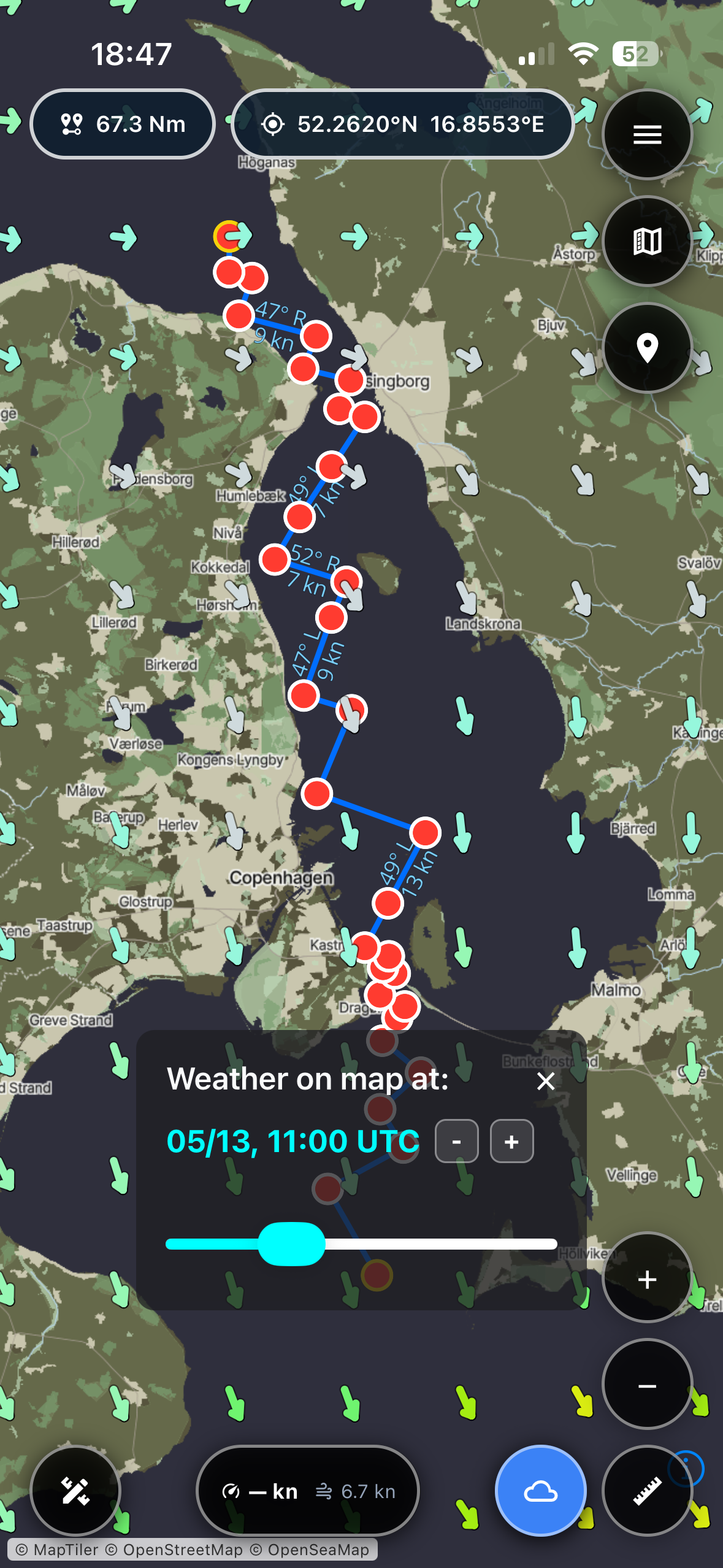
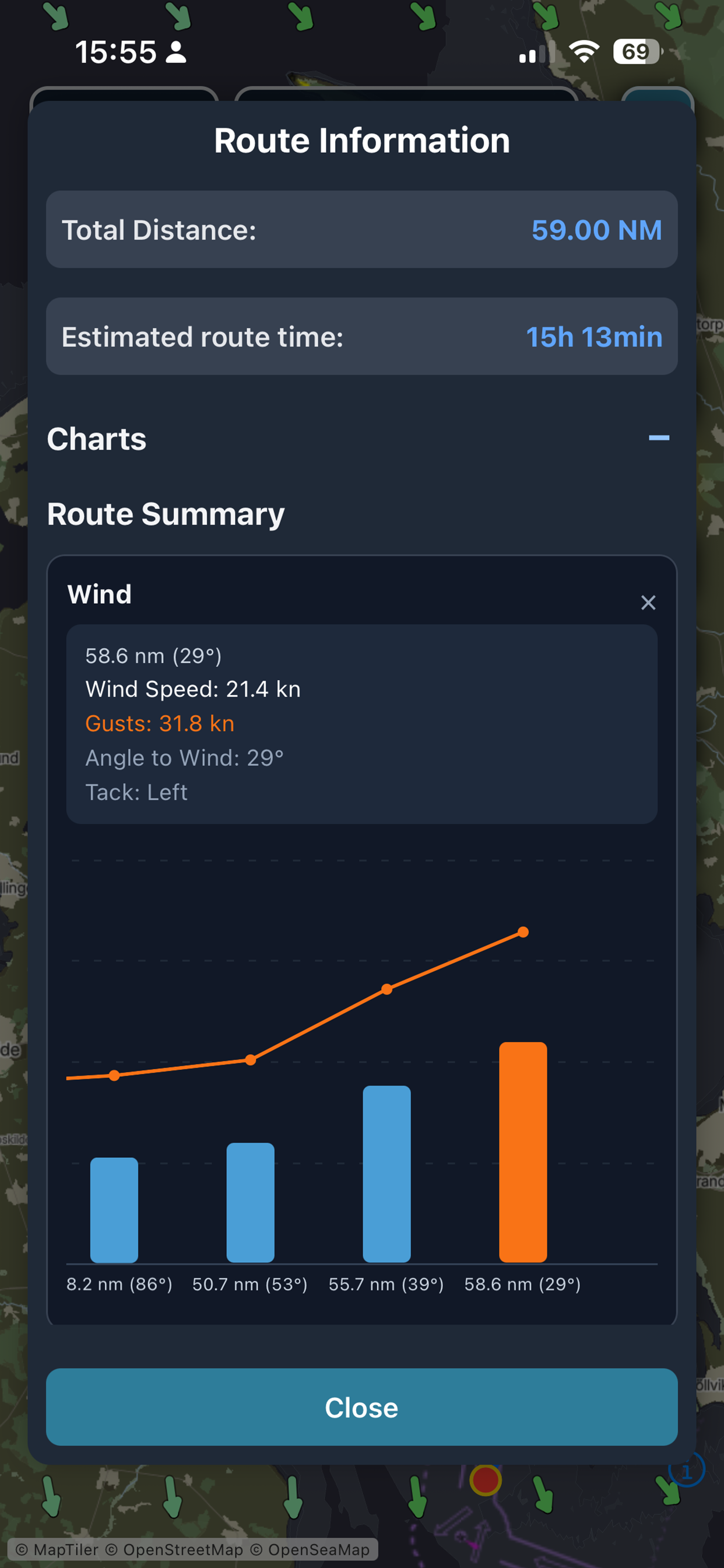
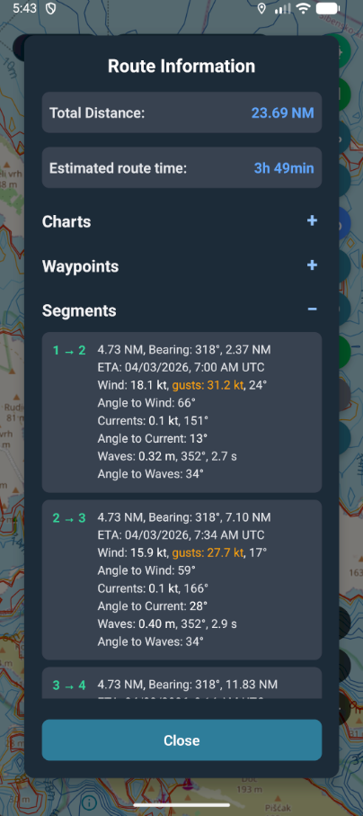
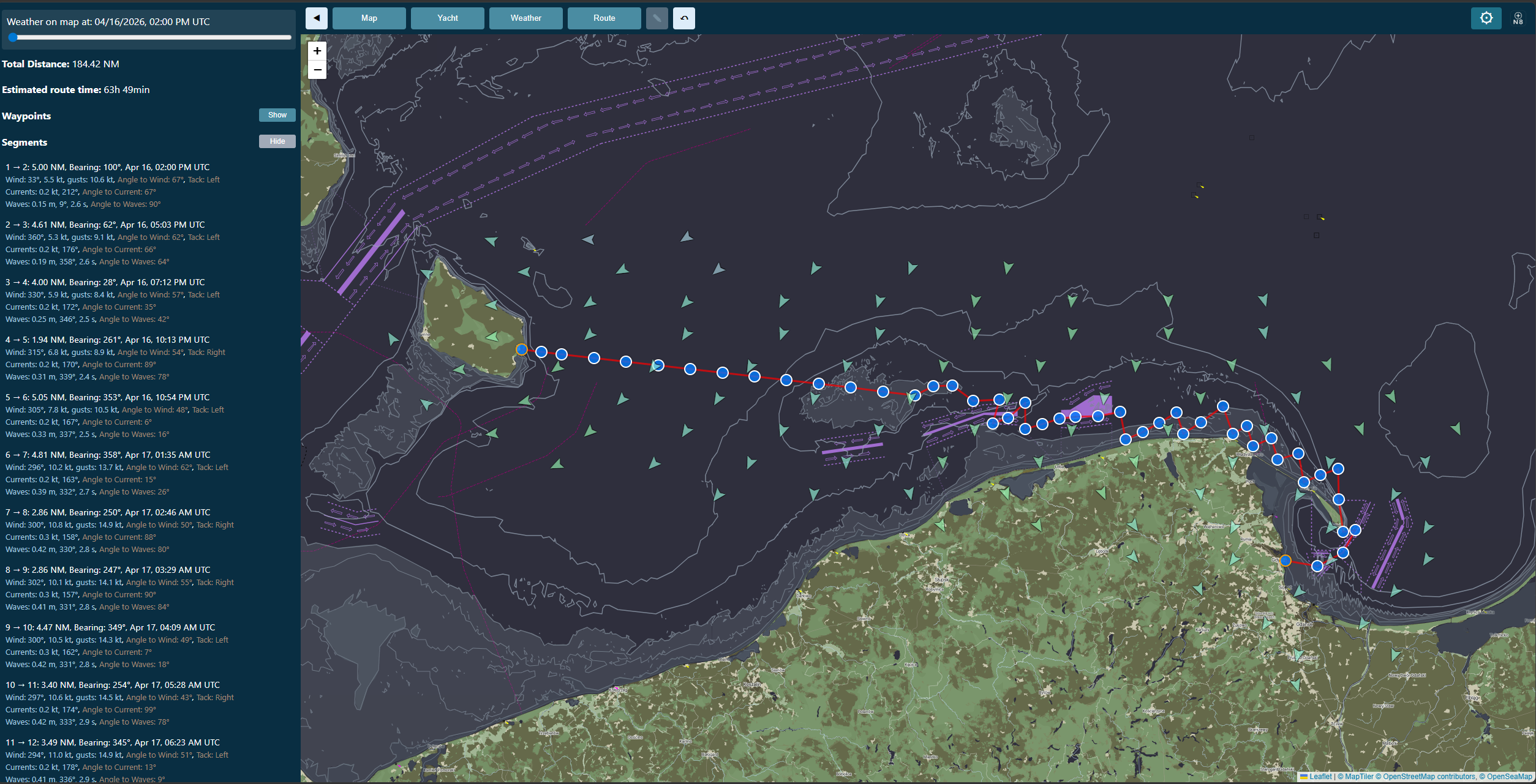
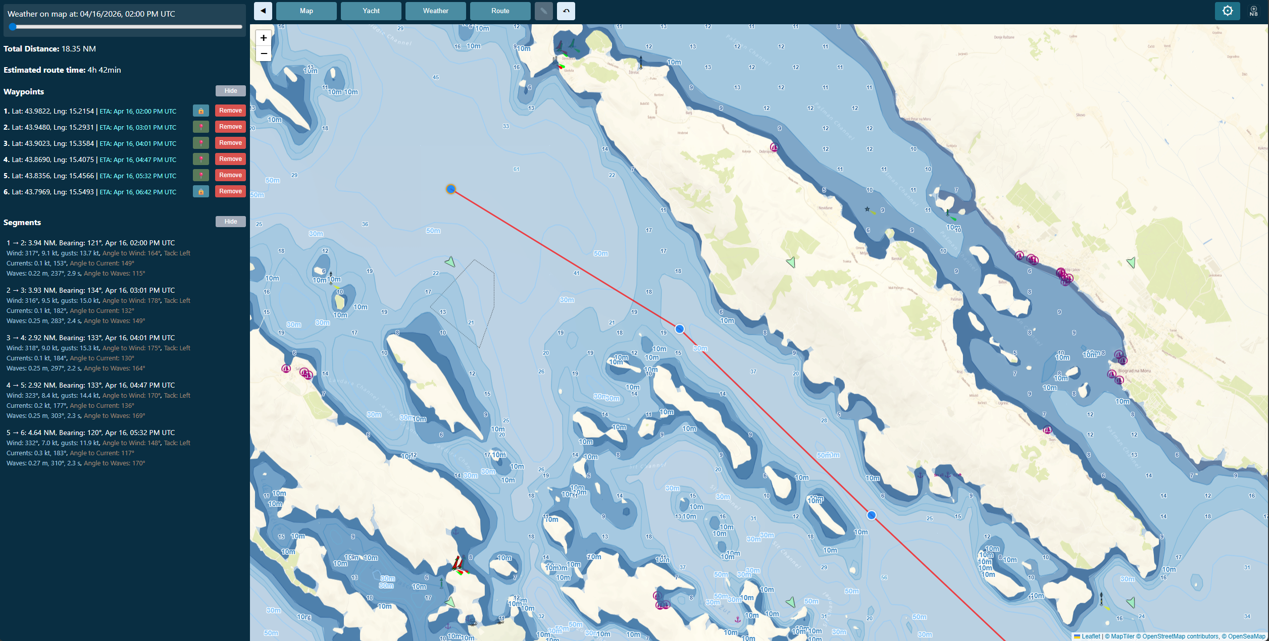
See the full picture across every leg of a multi-day passage, not just today's forecast.
Feel reassured with an app simple enough for the whole crew, even on a first trip.
Know exactly when conditions are calm enough to head out, and when to stay in port.
Brief the crew with clear, shared data everyone can see on one screen.
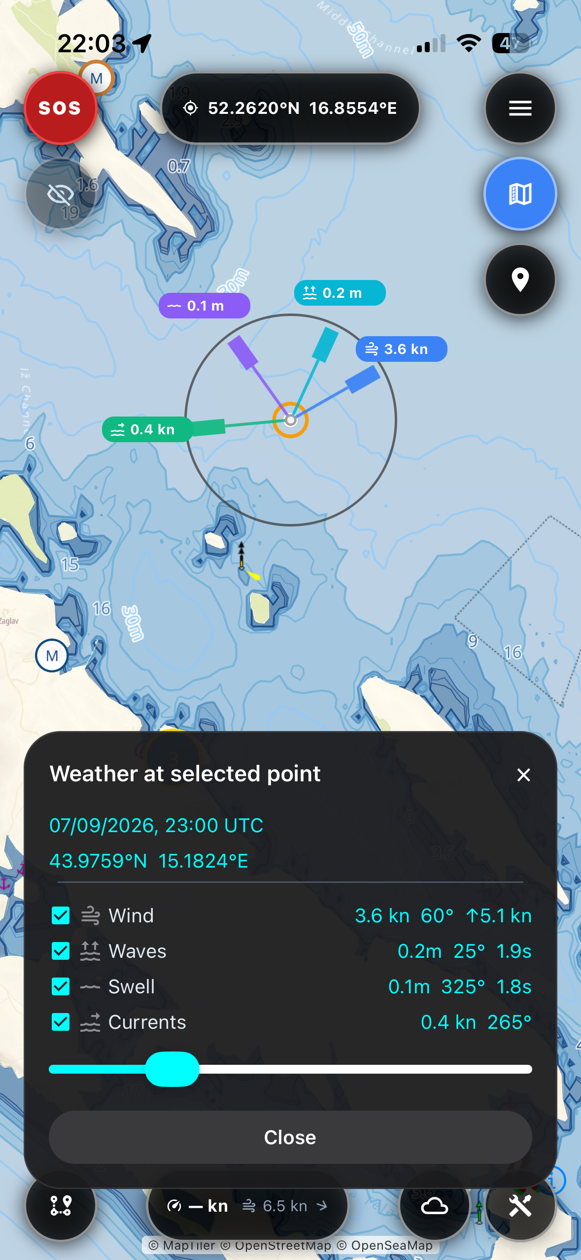
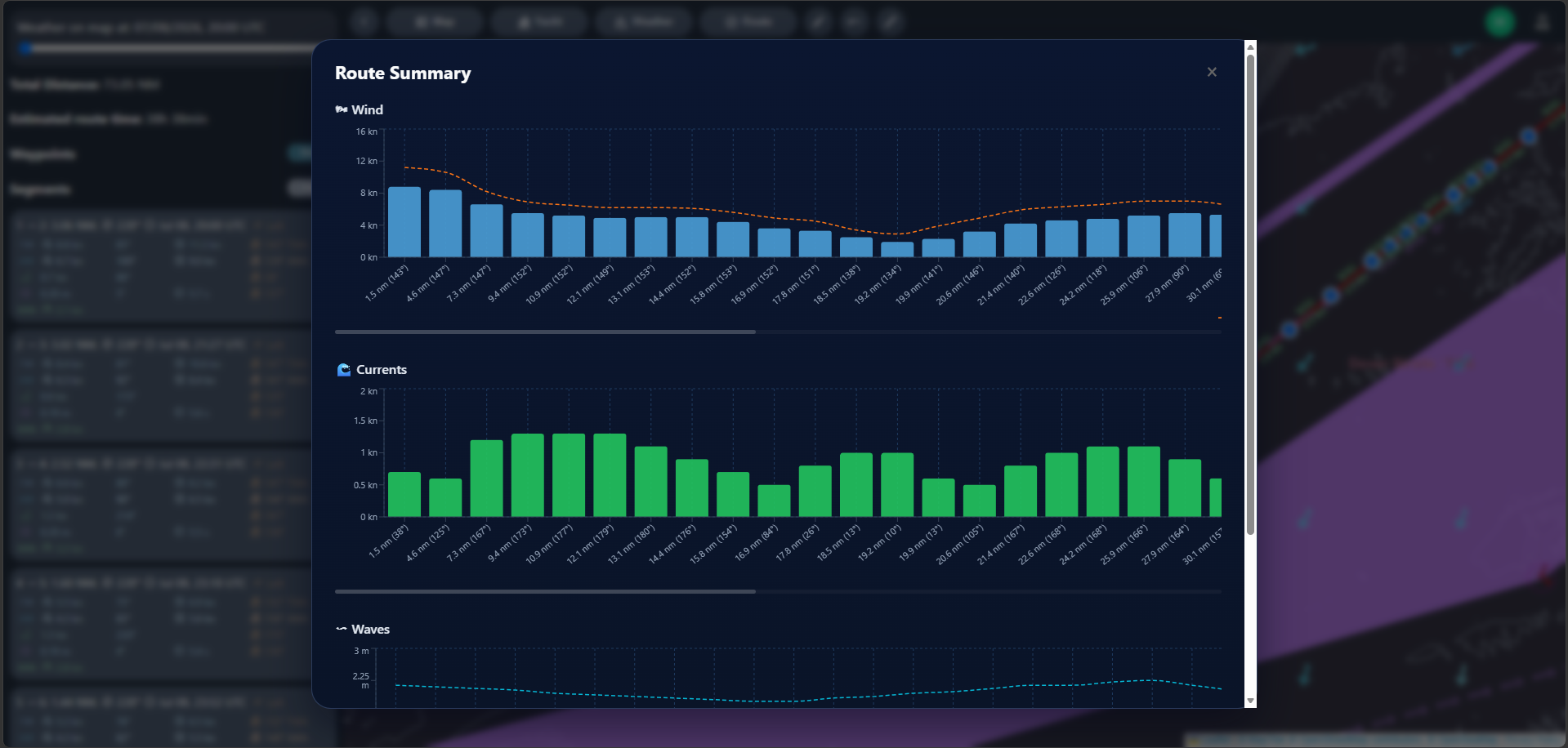
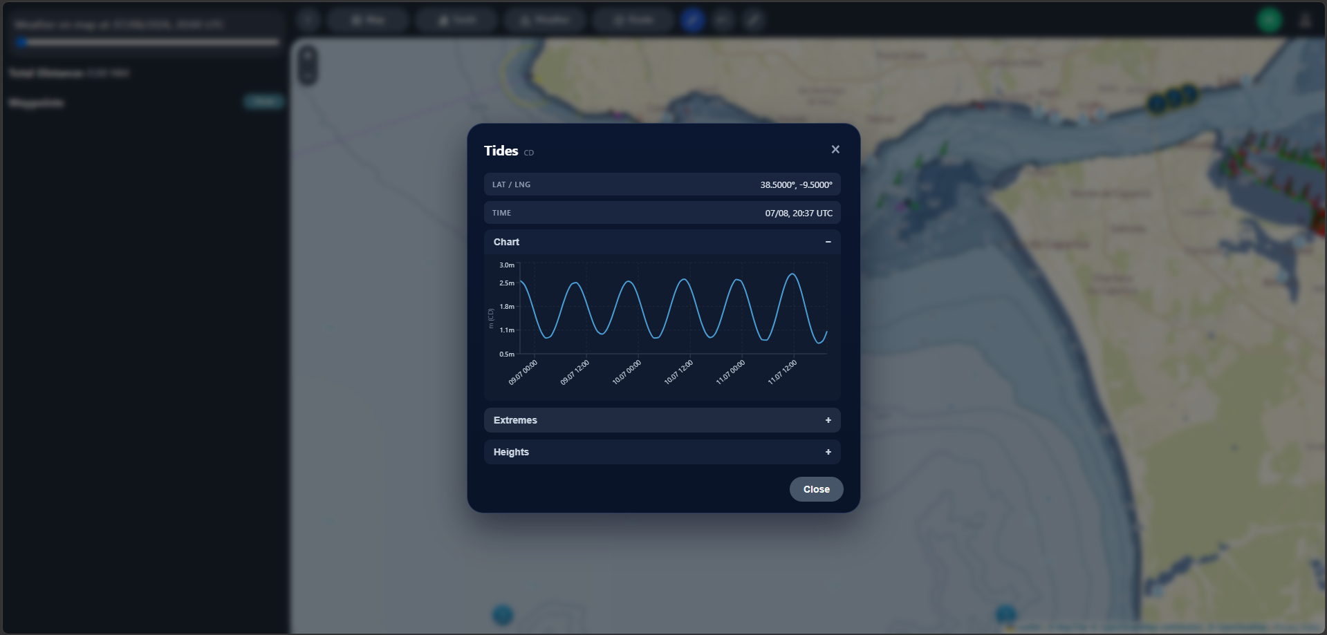
Dig into granular wind, current and wave data — the detail other apps hide behind a single icon.
Real outcomes, not just features.
You sail with more confidence, because you see not just the weather, but how it will actually affect your yacht.
You plan faster, because the app is simple and clear at a glance.
You avoid dangerous surprises, because hazards and shallow water are marked on your route, not buried in fine print.
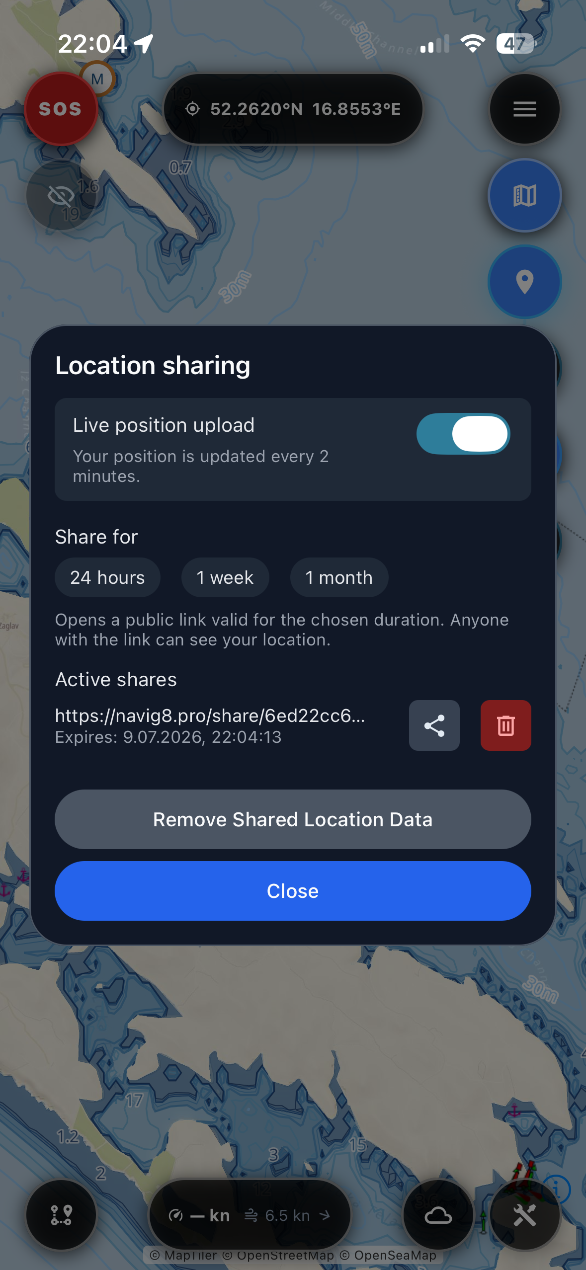
You never lose touch with your crew, because your location can be shared live with anyone who needs to know.
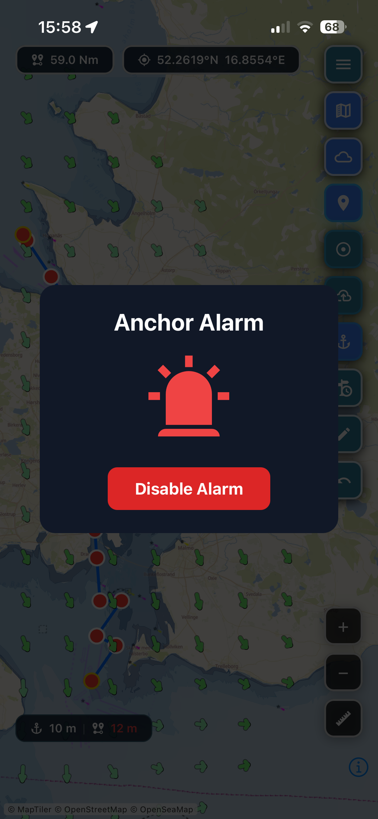
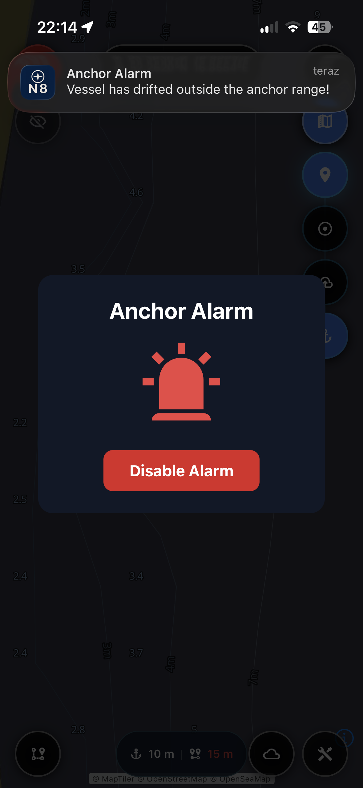
You sleep better at anchor, because the anchor alarm watches your position while you rest.
You stay in control offline, because your route and weather are cached for when signal disappears.
A quick preview of key Navig8 screens and usage scenarios.
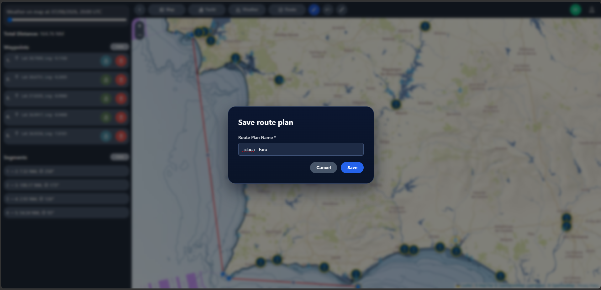
Desktop app screenshots.
We built Navig8 because passage planning shouldn't require five different apps, a meteorology degree, and a spreadsheet. Too many navigation tools try to do everything and end up doing nothing simply. We wanted one place where the weather, the tides, and the route just make sense — clear enough to trust in a hurry, simple enough to use every time you sail. No clutter, no learning curve, no guesswork. Just the information that keeps you safe, presented the way sailors actually think.
PRO isn't extra features for the sake of it — it's the difference between guessing and knowing when it matters most on the water.
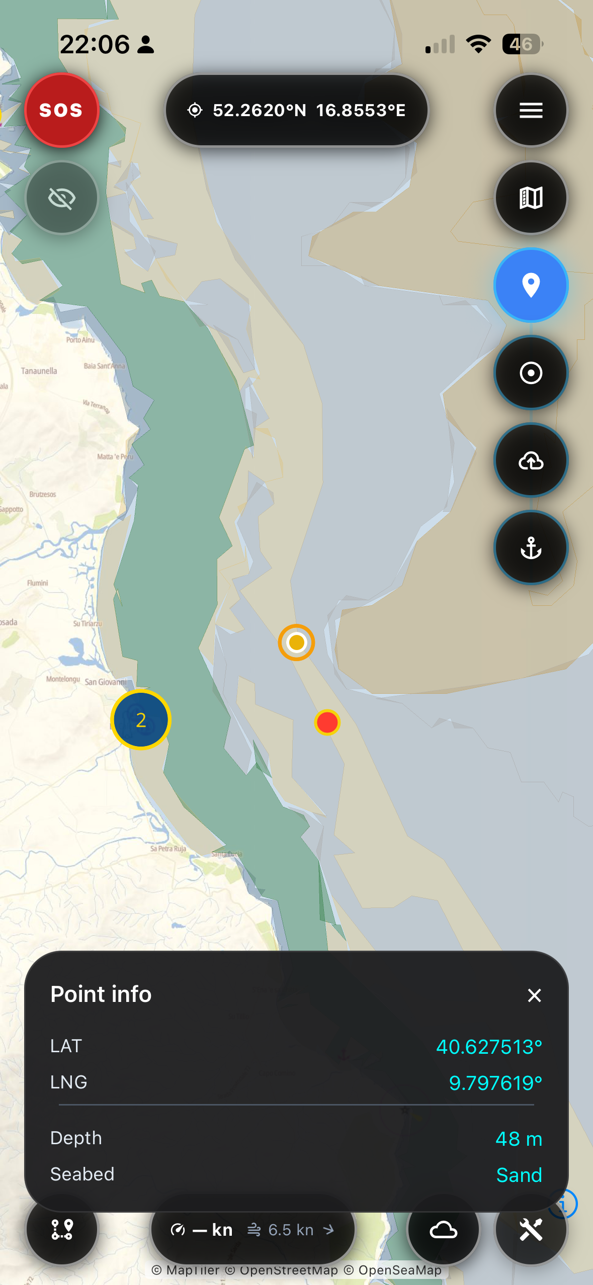
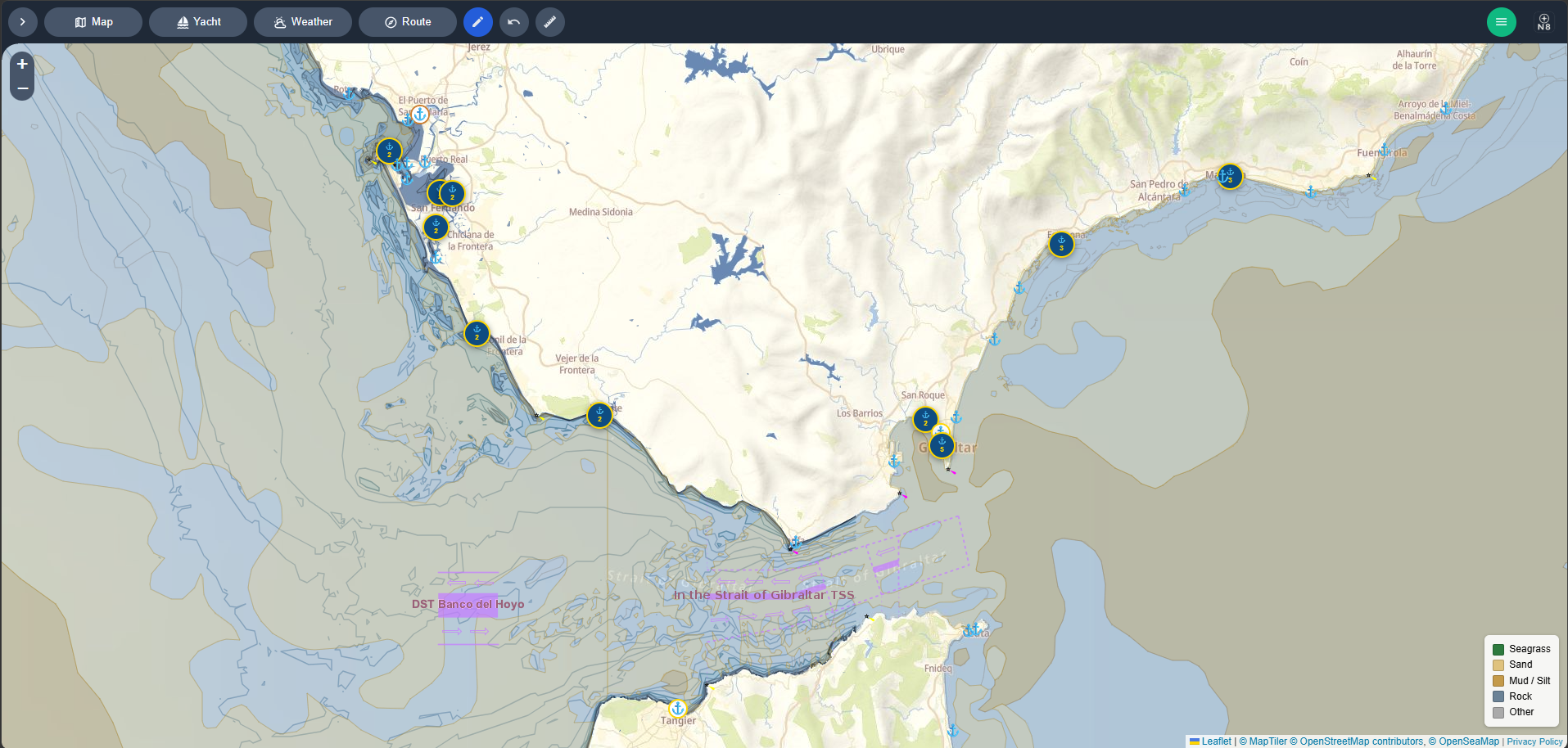
You avoid shallow water, because full bathymetry charts show seabed depth everywhere you sail.
You never worry about signal, because bathymetry and route data download for offline use.
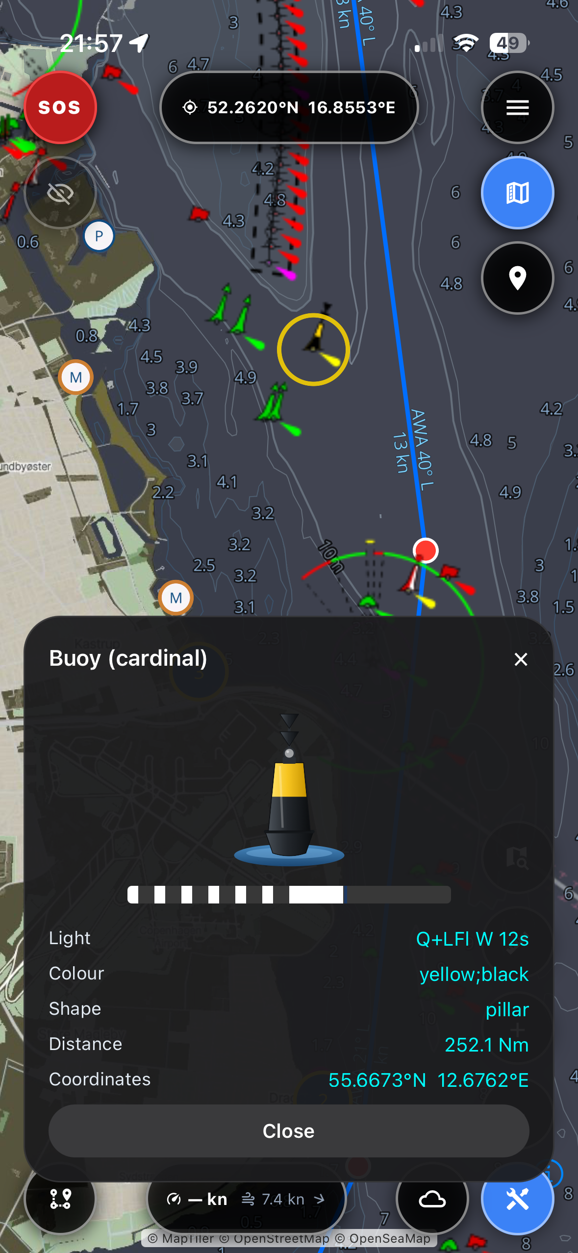
You spot hazards before they surprise you, because seamarks show detailed navigation aids — including an IALA light simulation for night passages.
You choose safer anchorages, because seabed composition data shows where your anchor will actually hold.
You stay aware of nearby traffic, because AIS shows vessels around you in real time.
You plan longer voyages with confidence, because PRO unlocks routes up to 1,000 nautical miles with advanced optimisation.
Try PRO free for 3 days, then just 19.99€ per year — start anytime from the account menu in the app. Cancel anytime, no risk.
One place for app access links and videos showing how Navig8 works.
Web, iOS, and Android versions.
App Store - search for "Navig8 Sailing"
Navig8 introduction - Desktop and Mobile
Free to start. Available on iOS and Android.
 Scan for iOS
 Scan for Android